EN
EN  VI
VI 


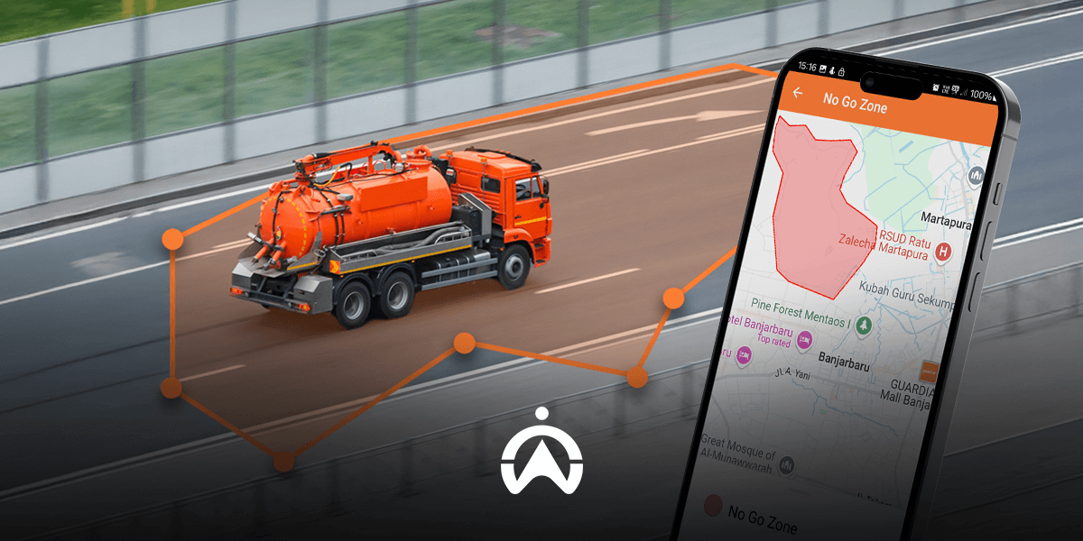
Technological advancements allow you to control your company's fleet more comprehensively and effectively. Today's GPS tracking devices are no longer limited to real-time vehicle location tracking; they offer a range of advanced management features and tools, most notably geofencing solutions.
If you're running a self-drive car rental or commercial vehicle rental business, have you ever considered limiting the operating range of your vehicles? This could be to adjust service pricing by region, or to ensure timely vehicle availability in emergency situations.
All these needs can be fully met thanks to the application of geofencing technology. In this article, we will help you understand what geofencing is, its operating principles, and how to apply this technology to optimize your company's fleet management.
What is geofencing?
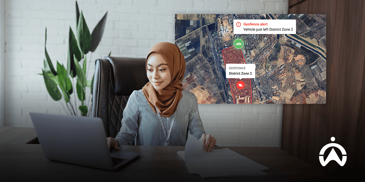
A geofencing system is a "virtual boundary" established to delineate specific areas on a digital map, corresponding to real-world geographical coordinates. Geofencing systems typically combine location data from GPS, Wi-Fi networks, cellular signals, etc., to automatically trigger corresponding control commands or responses.
Imagine you own a house with a fenced-off, enclosed garden. With geofencing technology, you can set up automatic responses whenever someone enters or leaves that area.
For example, you could set up a system that automatically sends notifications when a stranger enters your yard. Conversely, the system could also send an instant alert as soon as a family member leaves your yard.
See also: Cartrack GPS tracking device – A comprehensive solution for passenger transport businesses
Practical applications of geographical barriers in various fields
Operating as a flexible “virtual boundary,” geofencing can seamlessly integrate with various software ecosystems to enable diverse automation scenarios. Therefore, this feature is widely applied in many industries, including:
1. Location-based Marketing and Advertising
Have you ever walked into a shopping mall or complex and immediately received a promotional notification from a nearby store? Geofencing technology identifies your smartphone's GPS coordinates as soon as you enter the mall, automatically triggering promotional messages on your device.
2. Timekeeping and field personnel management
For businesses with a workforce dispersed across various construction sites or projects, geofencing technology is a powerful timekeeping tool. Through a dedicated application installed on employees' mobile phones, the system automatically records the start time of work as soon as they move into the designated coordinates of the project area.
3. Broadcast emergency alerts.
Geofencing is also used to disseminate information about rescue, natural disasters, or emergencies over a wide area. A typical example is SMS messages from the Early Warning System (EWS) being sent simultaneously to all mobile subscribers present in the area affected by the disaster.
4. Automating Smart Home Solutions
In a smart home model, geofencing allows for the activation of household electronic devices when the homeowner moves within a predetermined radius of the house. For example, the system can automatically turn on the lights and activate the air conditioner as soon as you step through the gate.
5. Access control and security
Geofencing applications allow you to instantly control the entry and exit of personal vehicles or family members to and from defined areas. This enables you to quickly detect potential unauthorized vehicle movement or immediately identify when children accidentally leave safe play areas.
Operating principles and application procedures of Geofence
A virtual geographic boundary (Geofence) can be flexibly customized as a custom polygon based on user-drawn boundaries, or a circle with a radius around a specific coordinate. Geofencing technology utilizes data from the Global Positioning System (GPS), Wi-Fi networks, Radio Frequency Identification (RFID) technology, or cellular data to trigger automated processing commands as soon as predefined conditions are met.
To deploy a geofencing solution, the first step is to create an account or subscribe to a service package on a dedicated platform/application that integrates this technology. After completing the registration, you will be granted access to the central administration dashboard to proceed with geofencing and set up corresponding automated action scenarios.

Standard steps for setting up a virtual geofence:
1. Initialization and Geofence
To set up geofencing, the first step is to register for a service package on a dedicated platform or application. After completing the registration process, you will receive access to the central administration interface, allowing you to easily define target geographic areas and set up automatic response rules.
2. Track and locate coordinates via GPS
Next, you install the specialized application, attach a professional GPS tracking device to the vehicle, or utilize the built-in GPS chip on your mobile device. This monitoring device will continuously transmit coordinate data to the system and trigger a response command as soon as the object crosses the defined geofencing boundary.
3. Set up action scenarios and configure alerts.
You can customize corresponding automated actions when an object moves into or out of a geofencing area. These actions range from sending push notifications and SMS alerts/promotions to transmitting control data to trigger peripheral systems such as automatic power off/start-locking of vehicles.
The benefits of applying geofencing in corporate fleet management
Despite its diverse application potential across many fields, geofencing technology demonstrates its greatest value in fleet management, particularly for businesses operating dozens to hundreds of vehicles, such as car rental companies, tour operators, or bus passenger transport businesses.
For businesses operating in the road transport and logistics sector, here are the most practical benefits that geofencing technology brings to fleet management processes:
1. Preventing and deterring vehicle theft
By establishing a Geofence with an instant notification mechanism, you will receive alerts immediately when a vehicle in your fleet moves outside the designated area. This allows administrators to proactively check and verify whether this constitutes theft or unauthorized vehicle use.
For example, you can contact the renter or driver directly to request an explanation for deviating from the agreed-upon route. In the event of vehicle theft, you can immediately implement emergency response measures such as remotely disabling the engine and reporting the incident to the authorities.
2. Planning and controlling the operational area
Geofencing is a powerful tool for businesses that use vehicles for commercial purposes and goods delivery. You can clearly define operating areas for each vehicle and set up automatic notifications when vehicles enter or exit those assigned areas.
This method makes it easy to monitor the accountability of your drivers or delivery staff, ensuring the entire operation runs smoothly and according to plan. It also provides a transparent database for reviewing and evaluating performance (KPIs) if drivers consistently experience delays.
3. Improve operational efficiency and optimize business productivity.
Data from geofencing plays a crucial role in enriching fleet performance analysis reporting systems, especially when combined with other measurement parameters from GPS devices. For example, you can accurately track the actual operating time of vehicles and assess driver driving habits within specific geographical areas.
Managers can leverage this information to optimize coordination processes and guide the driving behavior of their driver teams. This data also provides a solid foundation for leadership to formulate strategic operational policies, improve performance, and expand business scale.
See also: What is a GPS tracking device? Learn about its principles and applications!
Cartrack GPS devices integrate geofencing features
Cartrack's comprehensive fleet management solution offers a range of professional GPS tracking devices integrated with geofencing technology, establishing a robust security shield for all of your company's vehicle assets. You can directly access the intuitive dashboard to monitor vehicles in real time and receive instant notifications when a vehicle deviates from its permitted operating area.
In addition to advanced GPS tracking devices with geofencing capabilities, Cartrack also offers a comprehensive ecosystem of features to fully meet transportation needs:
-
Fuel sensors and monitoring: Specialized sensors accurately measure the amount of fuel remaining in the tank, helping to reduce waste and eliminate the risk of fuel theft.
-
LiveVision AI camera system and SmartCabin: Smart dashcam and cabin camera solutions that utilize artificial intelligence (AI) help identify distracted driving behavior and improve vehicle safety standards.
-
Power cut-off relay / Remote start lock (Immobilizer): This allows you to proactively prevent vehicle theft by remotely disabling the vehicle's ignition/starting system via software.
Geofencing is a technological solution capable of automatically triggering intelligent response scenarios when an object moves into or out of a predefined geographic area. One of the most valuable applications of geofencing is its integration with GPS data to comprehensively optimize fleet management.
Geographic fence solutions for fleet management can be flexibly applied to a variety of business models, from car rental services, express delivery services, long-distance freight logistics to businesses renting heavy machinery and construction equipment. Security and asset loss prevention will be significantly improved when you can proactively and instantly track when vehicles leave their permitted operating areas.
Strengthen security and optimize your fleet management capabilities today with GPS tracking devices with integrated geofencing from Cartrack! Click the link below and leave your contact information to receive a quote for the most optimal GPS tracking solution for your business needs.